Variscite, sun tunnels and the Devil’s Playground in Lucin Utah
A rare and beautiful blue-green gemstone, Variscite is found in isolated spots in Utah and Nevada. Variscite [var-uh-sahyt] is sometimes mistaken for Turquoise, and harder varities are sometimes sold as Variquoise. It has a range of colors from pure, glassy emerald green through the blue-green of tropical seas, and occasionally almost sky blue.
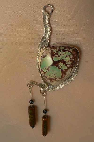
The piece on the right started as an interpretation of a bronze age hatchet. The bronze colored matrix around green variscite is very rare. This material is hard to work, as it fractures easily. After many attempts I worked out a technique to grind down from the bronze matrix and green variscite toward the limestone host rock, leaving just enough material to create a color layer. It’s a bit like cutting opal – a bit too far and the piece is ruined.
 |
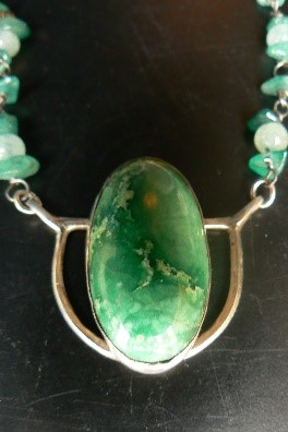 |
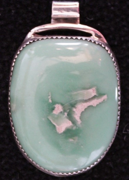
Variscite makes some beautiful jewelry. It’s easy to work, and the results range from soft to spectacular.
My first experiments with cutting and setting were in a Geometric style, a throwback to my mom and other Modernist artists.
Most of the Variscite in North America is under private claim, but a small outcrop is accessible on public land West of the Great Salt Lake. It’s in a spectacularly beautiful area near the ghost town of Lucin.
Lucin sprung up over a hundred ago, at a small oasis on the route of the transcontinental railroad. In the days of coal-burning locomotives, frequent water stops were needed to fill the tanks of the locomotives. Fertile parts of the country had water stops almost anywhere, but in the parched deserts of Utah and Nevada water is scarce. After crossing the vast expanse of salt flats west of the Great Salt Lake, trains would stop at the first spring in Lucin.
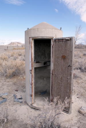
Lucin is now just a small sign and a couple of ancient cottonwood trees. A few years ago there were two concrete phone booths, the only remnants of the town. Dave Beedon has a nice description of the town in his
blog.
The town once had the only school for many many miles. Kids would catch a train, just like the kids catch a bus now, and the train would drop them off at the one room school house.
To get there, we take Interstate 80 west past the Great Salt Lake, and turn off at the Bonneville Salt Flats. You probably know that Bonneville is where adventurers try to break the world land speed records every year. The winter rains swell the lake, and its waters edge westward. After dissolving the salt in the winter, the lake retreats eastward under the drying sun of springtime. By summer a new surface of perfectly flat, hard salt stretches many miles across the desert. This gleaming white surface is perfect for racing the fastest land vehicles on earth.
A long finger of granite, the Silver Island Mountains, pokes eastward into the salt flats at Bonneville. We turn off of the Interstate, fill our gas tanks, and start up over the mountains on the dirt road.
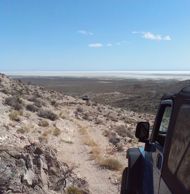
Sometimes we stop in the mountains to prospect for crystal quarts filled with streaks of bright green Malachite and pure silver.
This picture shows my Jeep and some friends near one of the abandoned silver mines, high above the salt flats.
After crossing the Silver Island Mountains, we travel through sparse grassland at the edge of the salt flats. Every twenty or thirty miles a small ranch house appears, where hardy souls attempt to wrest a living from this unforgiving moonscape.
An hour’s drive from Bonneville gets us to Lucin, but there’s really no reason to stop at the old ghost town. We cross the tracks of the intercontinental railroad, sometimes waiting for one of the long trains to cross first. Most of the trains are common, but there are some interesting loads on a few. At the time of the Iraq wars I would see long lines of armored vehicles heading west to the ships that would carry them to battle,. At other times I’ve seen the tubes of giant rockets on board, on their way to be loaded with nuclear warheads. This desert is a good place to think about the fate of man.
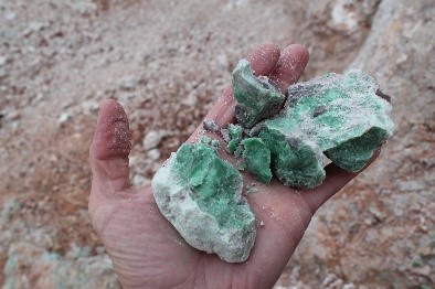
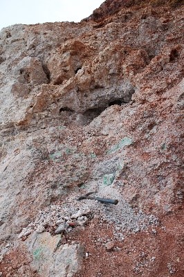
North of Lucin a few miles is an unmarked gate. I turn off the main road onto a rutted track that leads up to the mine. It’s pretty rough. (Warning! When Henry say’s it’s pretty rough, most people will get out and walk!). After crossing the ridgeline you come to the abandoned mine. At one time there was enough material here for a commercial operation, but that’s long gone. Small chips abound, enough to make plenty of jewelry. Patient searching will also uncover pure nuggets to make many cabochons. The big blocks have all been taken away, and mostly small rubble remains. Like most mines, the pit is not very photogenic, but the surrounding area is spectacular.
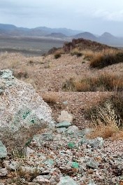
A patient hunt will still find nodules of excellent Variscite, but they are few and far between. These photos of one dig show some superb material that has made stunning jewelry.
The ridge sits a few hundred feet above the desert floor. You don’t often see anything moving out there, but sometimes the flyboys from Hill Air Force Base practice their low level tricks out there. It’s astonishing to be sitting in total silence, and suddenly hear the roar of approaching jets. A few moments later a couple of F-16’s will roar past, below my vantage point, racing a hundred feet above the desert at five hundred miles per hour.
Out to the west of Lucin is another amazing location. The Sun Tubes are art forms placed on the flats by artist Nancy Holt. These huge concrete cylinders are perforated with the patterns of constellations, giving you your own personal planetarium. They are aligned to view the rising sun at the Winter and Summer solstices. The Utah Museum of Fine Art has a
thorough discussion of the significance and location of this unforgettable experience.
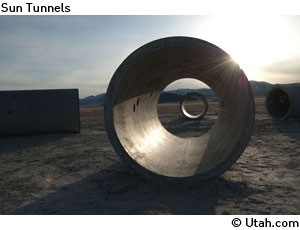
Early morning at the Sun Tunnels, from
Utah.com
Another fascinating spot in the area is the
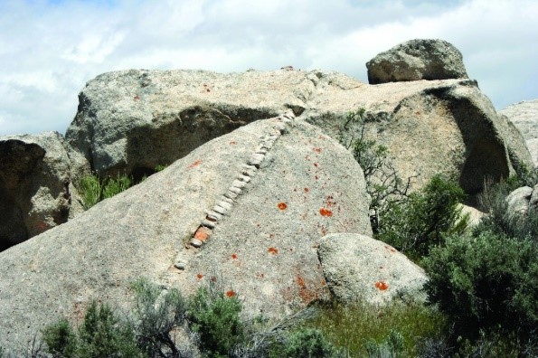
Devil’s Playground. It’s about ten miles north of the Variscite digs. The hard granite has been fractured by eons of ‘onionskin’ weathering, creating fantastic towers and weird formations above soft sands. At the north end of the Devil’s Playground are pegmatite ‘dikes’ along a geologic fault line that runs straight as an arrow from the mountains to the lake shore. The fault has cracked open in eons past, and as the earth’s interior pressed up and out it left behind lots of perfectly clear quartz crystals. Most of the crystals take hard rock mining to extract, but sometimes you will dig into a ‘collapsed pocket’ where the crystals are floating in soft dirt.
More information about this wild geology is found on the Geology Utah website
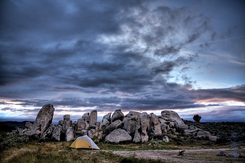
Camping at the Devil’s Playground area in Box Elder County, Utah.
Photo courtesy of Clint Huffman.
The Devil’s Playground is a great place to camp. Not only do you have spectacular scenery, but there are places where the eroded sandstone has washed down into flat, sandy ‘beaches’ which make a very comfortable place to lay down and sleep. Clint Huffman has some great pictures in his Flickr page.
Click here to view more of Clint’s photography.


 Lucin is now just a small sign and a couple of ancient cottonwood trees. A few years ago there were two concrete phone booths, the only remnants of the town. Dave Beedon has a nice description of the town in his
  Sometimes we stop in the mountains to prospect for crystal quarts filled with streaks of bright green Malachite and pure silver.


 Early morning at the Sun Tunnels, from
  Another fascinating spot in the area is the
  Camping at the Devil’s Playground area in Box Elder County, Utah.